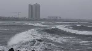
Heavy to very heavy rains are expected over the Tamil Nadu coast for the next 2-3 days due to the severe cyclonic storm ‘Fengal’, which turned into a cyclonic storm after midnight on Thursday. According to S Balachandran, executive director of the Regional Meteorological Center, the deep depression over the southwest inlet of Bengal will move north-northwestwards, avoiding the Sri Lanka coast and intensify into a cyclonic storm. By the morning of November 30, it will cross the northern Tamil Nadu-Puducherry coasts between Karaikal and Mahabalipuram.

10 best updates on Chennai weather:
Located about 300 km south-east of Nagapattinam, 400 km south-east of Puducherry and 480 km south-east of Chennai, the cyclonic storm will intensify into a cyclonic storm this evening or early tomorrow morning, but it will emerge as a deep cyclonic storm while crossing the coast between Karaikal and Mahabalipuram.
“It would cross north Tamil Nadu-Puducherry coasts between Karaikal and Mahabalipuram around the morning of November 30 with wind speed reaching 50-60 kmph gusting to 70 kmph,” the weather department bulletin said.
Tamil Nadu and Puducherry have forecast heavy rains with possibility of crossing Chennai coast.
There is a possibility that this severe cyclone may intensify into a cyclonic storm with wind speed ranging from 65-75 kmph gusting to 85 kmph over south-west Bengal, Balachandran said.


